

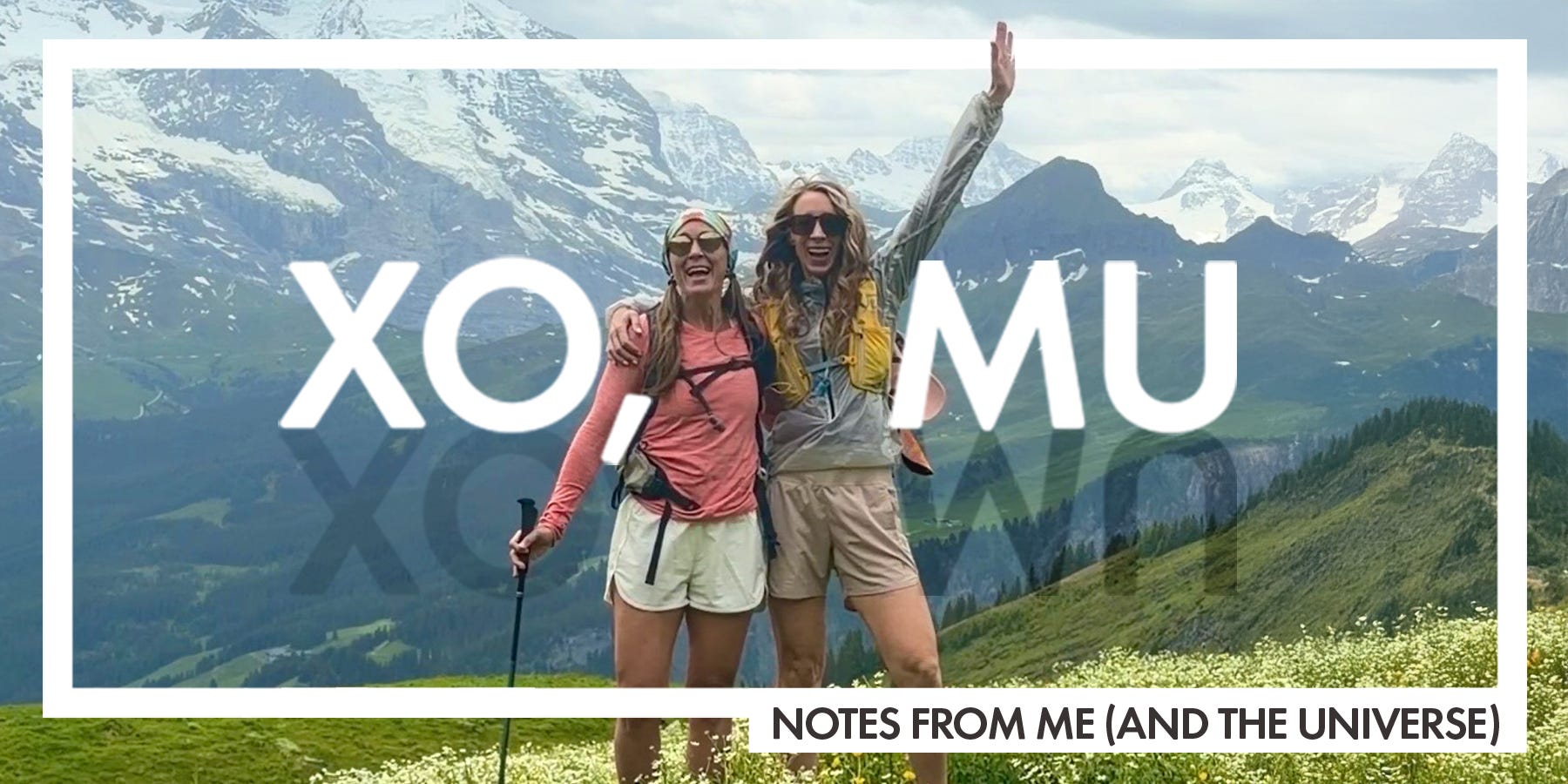
My Switzerland itinerary, part 1 (June 2026)
My sister and I spent 9 days exploring Switzerland. Here's our full itinerary, including where we stayed and what we did.

My sister texted me in early May: “Is there any chance you can get time off in mid-June? I’ll be in Italy for work, and took the following week off. Want to meet me and hike?” It was short notice, but the timing worked, and we’d been trying to plan an Alps trip for years.
I met her in Italy, and spent two days exploring Milan and getting used to the time change. On June 13, we took a train from Milan to Switzerland—and we were off and running.
Switzerland isn’t tiny—it’s the size of Vermont and New Hampshire combined—and we didn’t want to be packing and unpacking a million times. We decided on four days in Wengen (the Jungfrau region of the Swiss Alps) and four days in Kandersteg (the Bernese Oberland region). Both were great hubs for hiking, and were just two hours from each other by train (although we did have four transfers).
🇨🇭 BONUS 🇨🇭 Don’t forget to read 10 Things I Wish I Knew Before Coming to Switzerland for my best tips and must-haves.
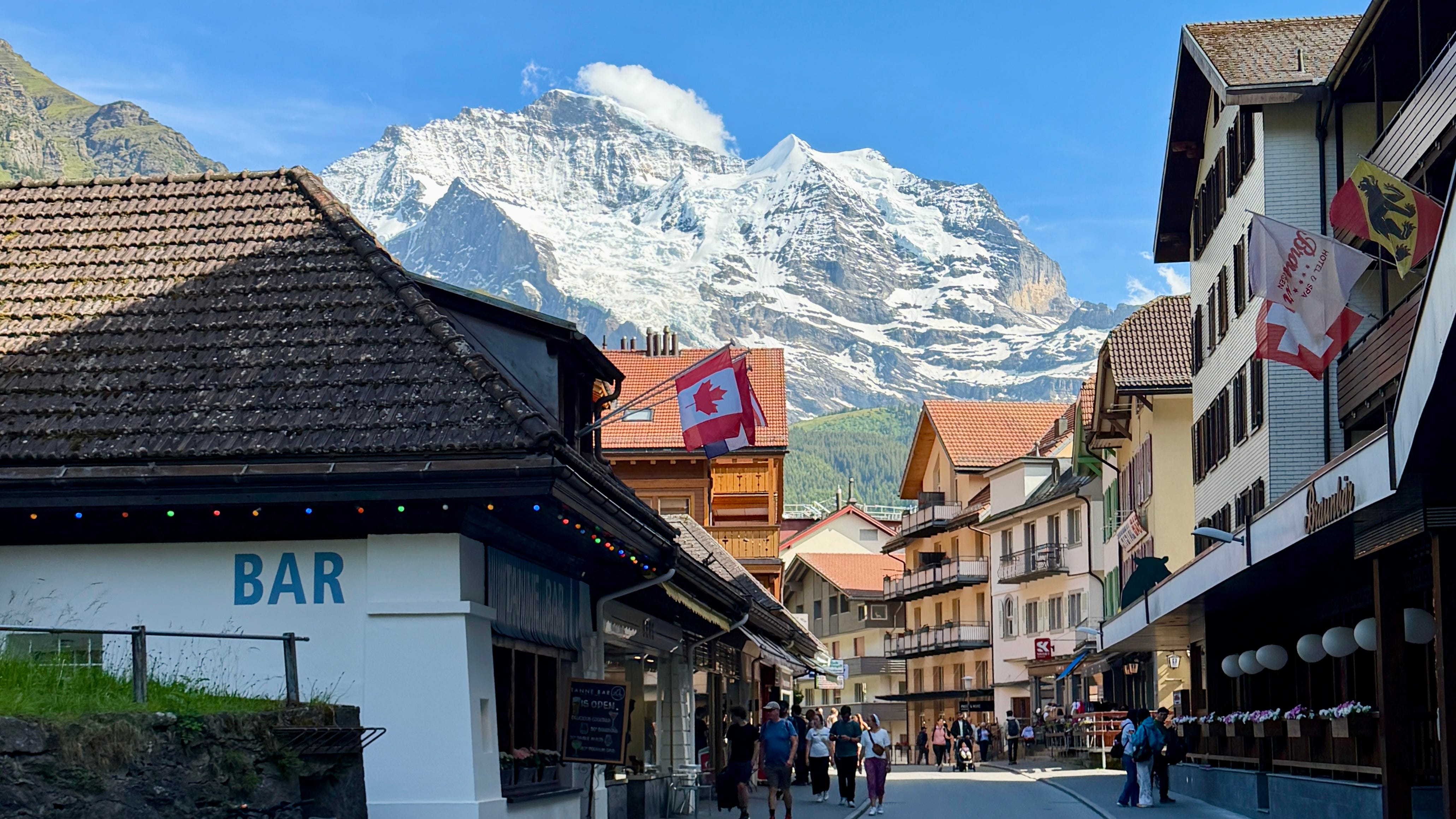
Travel Guide: Wengen, Switzerland
Wengen is a picturesque car-free mountain village sitting around 4,000 feet. We stayed in a 2-bedroom Airbnb called Chalet Krokus 6, and it was perfect. It was just a short (flat) walk from the train station, centrally located in Wengen’s “downtown,” and very quiet. The views from the balcony were unreal.
Day 0, arrival
We checked into the Airbnb around 4 PM, then went to the rooftop deck at Hotel Silberhorn, near the train station. We ordered a meat and cheese board, and it was the perfect start to the trip.
Day 1, Wengen → Wengernalp (ish) → Bigenalp → Kleine Scheidegg
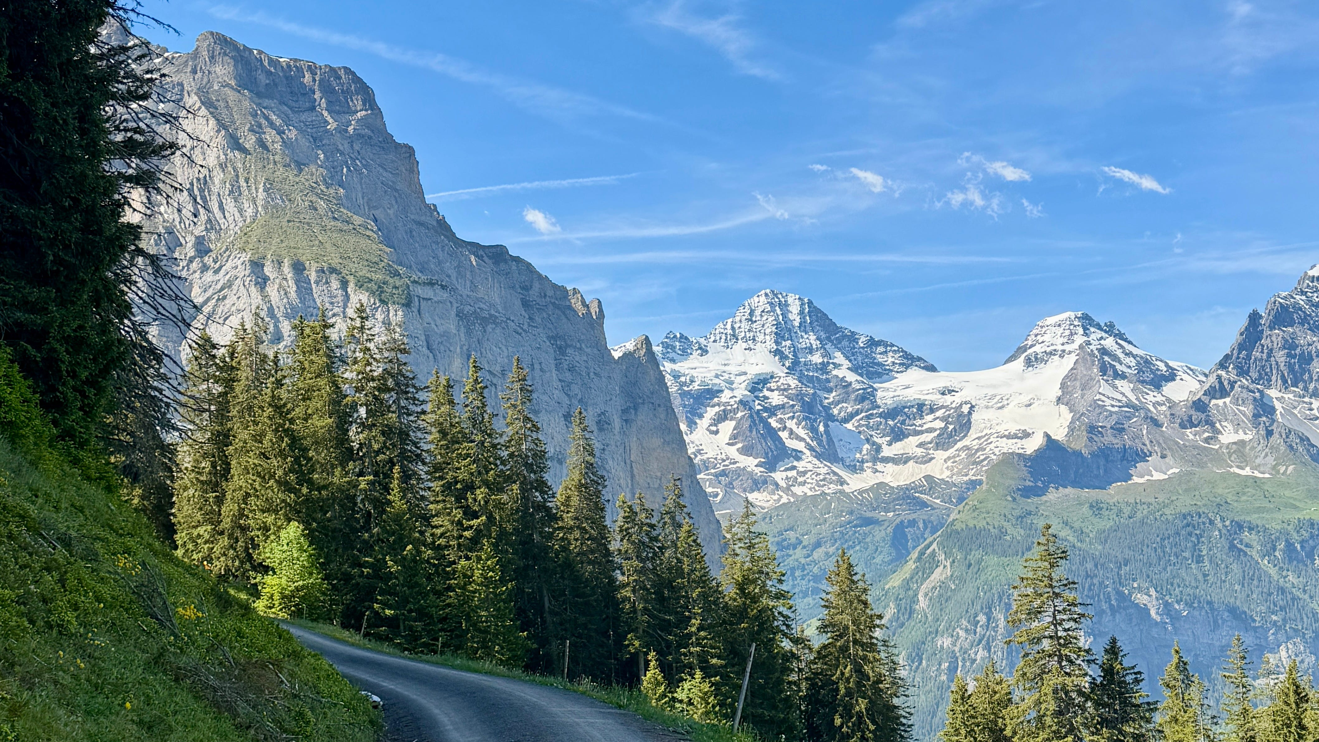
This was my favorite hike of the whole trip, and it was very off the beaten path. Most people take the train up to Kleine Scheidegg, then hike part of the trail down. We did not do this. Instead, we climbed 3,000 feet in almost 8 miles, starting in Wengen. We hiked around Wengernalp on the lesser-traveled Bigenalp trail, which was stunning beyond belief. (And also quiet—we saw maybe three people all day.) Bigenalp ends at the Kleine Scheidegg train station, where they have everything you might need—restrooms, restaurants, bars, and more. We ate our PB&Js before taking the train back down to Wengen. Expect cows, sweeping views of the Eiger, waterfalls—quintessential Switzerland. Find it on AllTrails—just hike it backwards.
Note, I really wanted to add the Eiger Trail to this route, but it wasn’t yet open. June can be considered “early” for some areas at higher elevation, and the trail still had a lot of snow and avalanche risk.
Day 2, First → Bachalpsee → Faulhorn → Bussalp → Grindelwald
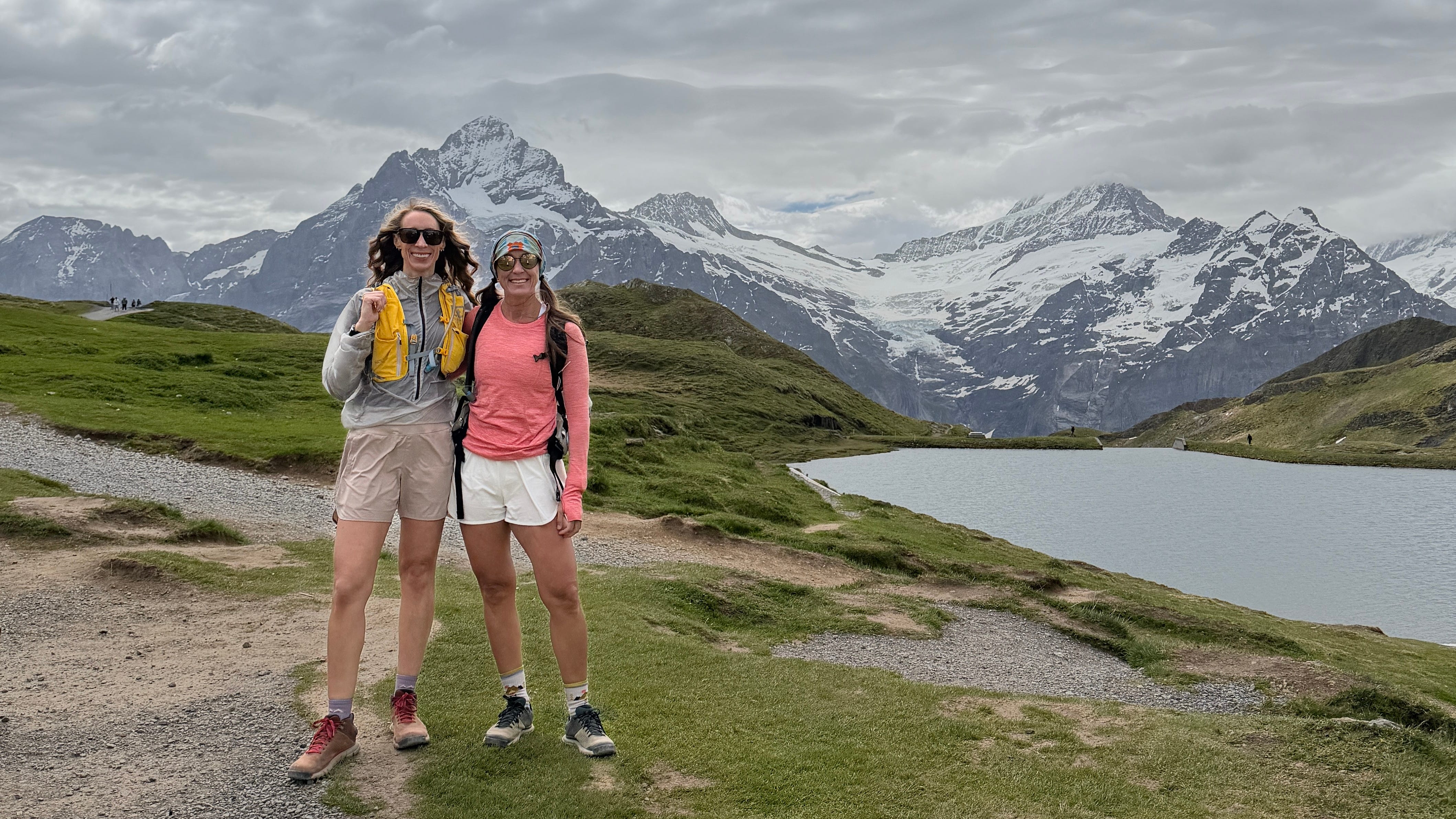
We got a little spontaneous on this one—and paid for it the next day (in a good way). We took a train from Wengen to Grindelwald, a much busier town nestled under the Eiger’s north face. From Grindelwald, we took a cable car up to First, then hiked to Bachalpsee (Lake Bachalp). This part of the hike was like Disney, TBH. At just 4 miles round trip with 700 feet of gain, it’s highly accessible (see AllTrails), and hugely popular. There were lots of families, lots of kids, and more than a few brides and grooms doing photo shoots. Many people came for the First Cliff Walk, a suspended platform just off the gondola station with stunning views.
The lake was gorgeous, although much colder and windier, at nearly 8,000 feet. From there, we continued up past the lake towards Faulhorn. It was two miles and pretty steep, with plenty of snow still on the trail. (This trail will get you to Faulhorn, then down to Bussalp. I often had to cobble trails together like this on AllTrails, but it wasn’t hard.) Faulhorn is normally a lovely pit-stop, with a restaurant and patio, but it wasn’t yet open. It was so cold and windy that we did not linger.
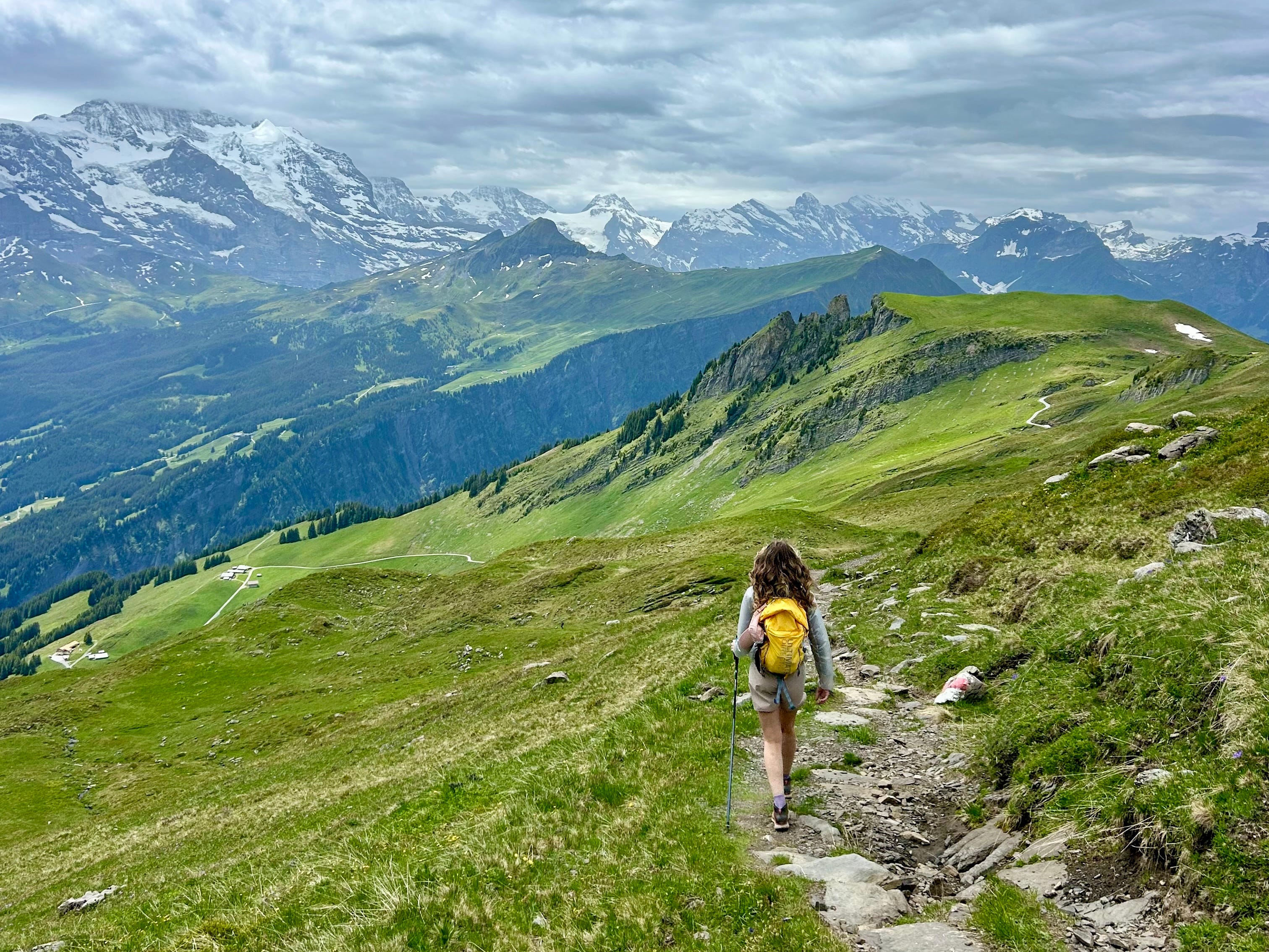
From Faulhorn, we started to descend another two miles to Bussalp. This was probably the prettiest part of the hike—so green, with striking, towering cliffs and beautiful wildflowers. The plan was to take a bus from Bussalp back to Wengen, but when we got to Bussalp (a tiny little town), we could look down and see Grindelwald—where we started—nestled into the valley below. We still had gas in the tank, so we decided to hike down.
This was intense. From Faulhorn to Grindelwald, we lost about 5,500 feet in just over 6 miles. (If you’re not familiar with elevation gain/loss, this translates to “steep AF.”) Still, the trail was easy to follow, as there were plenty of signs. (We didn’t need AllTrails for this.) And this was like six different hikes in one—we went through forests, fields of wildflowers, down gravel roads, through farmland, and eventually, into town. Our legs were sore for days.
Would I recommend this last part of the hike? Only if you’re really comfortable with downhill, your knees can handle it, and you’ve got poles. (The gravel sections were sketchy.) But it was incredibly pretty, and very rewarding to walk back to Grindelwald under our own power. We thought about staying in Grindelwald for dinner, but it’s so much busier than Wengen, so we caught the train back.
Note: I really wanted to try the iconic (and hard) Schynige Platte → First trail, which would have made for a very different hike… but again, it wasn’t yet open.
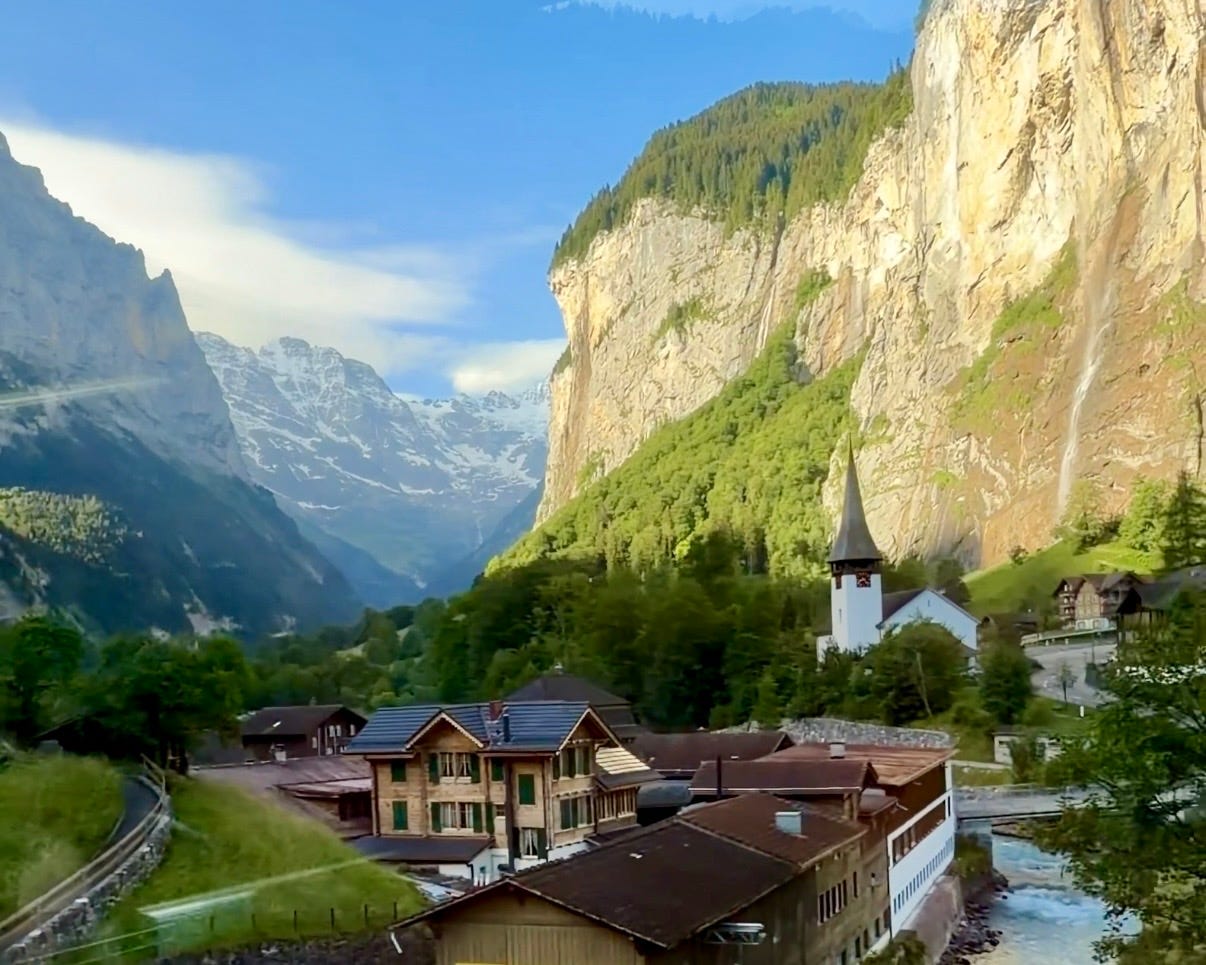
Day 3, “town day” in Lauterbrunnen
Lauterbrunnen is a stunning alpine village much bigger and busier than Wengen. It’s known as the “valley of 72 waterfalls,” including the impressive Staubbach Falls.
We took the train to Lauterbrunnen, then began the walk through town. There is a paved pedestrian path, which goes for miles and was so gorgeous. We skipped Staubbach Falls, as the line to get up close was ridiculous. (We admired it from the ground.)
We walked two miles to Trümmelbach Falls, a series of 10 glacier-fed waterfalls contained within a cave system. This was unbelievable. You take a short tunnel lift to access the caves, then walk up and down stairs to the 10 waterfall viewing stations. The falls were so much larger and stronger than we imagined—the sound of rushing water was so incredibly loud, and you 100% get wet. Though it was busy, we were able to find space at each viewing station, and took a ton of videos and pics.
From there, we continued walking to Stechelberg, also on the pedestrian path. We were able to walk right past the spot where the paragliders landed! From there, we took the cable car (the steepest in the world) up to Mürren.
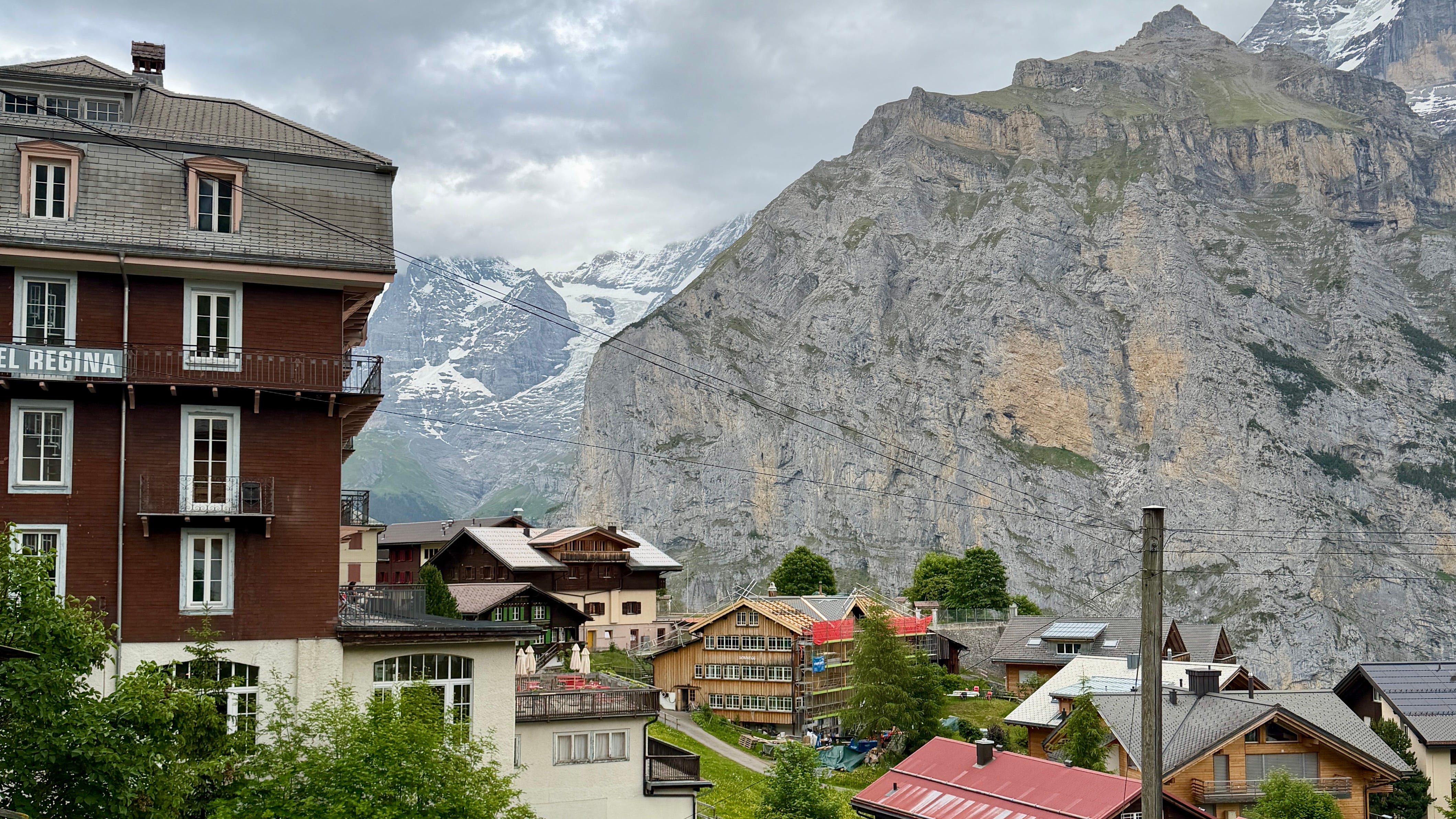
Mürren had the most gorgeous views, although it was quite overcast. Many of the shops were closed (it was around 4 PM), so we walked, took in the views, and stopped for dinner on the most beautiful terrace. After dinner, we took the cable car back down to Stechelberg, a bus back to the Lauterbrunnen train station, and a train back to Wengen. This was another 10-mile day, but much flatter and easier than any of our hikes.
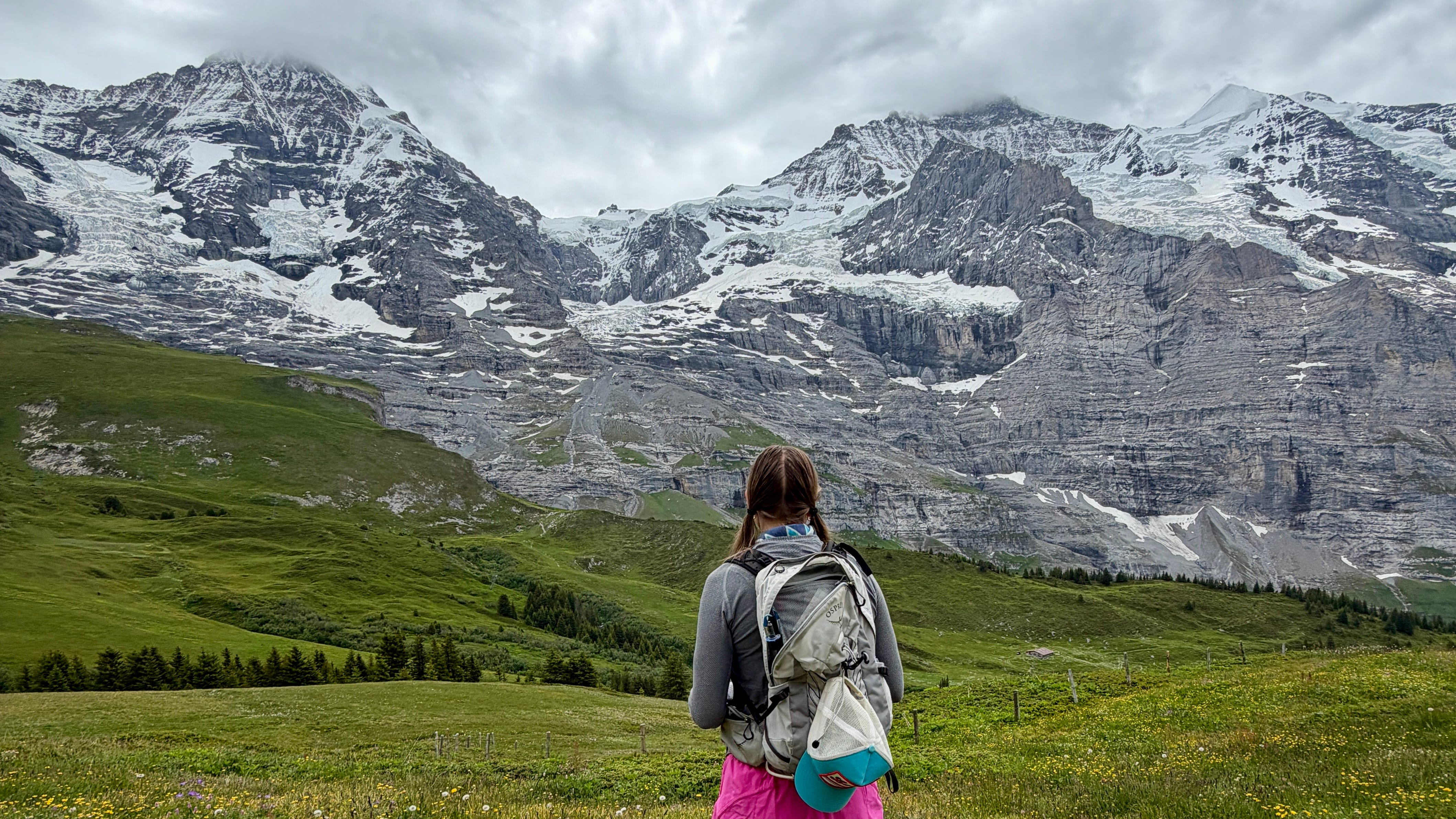
Day 4, short hike and train to Kandersteg
This was supposed to be a travel day, but there was one hike from Wengen that we hadn’t yet done. From town, we took the cable car up to Männlichen, then hiked (in one direction) from Männlichen to Kleine Scheidegg on the Panorama Trail. This trail is mostly flat and quite short (three miles), with sweeping views. It’s also super crowded, given it’s one of the more accessible hikes in the area. We were still able to find our own space, however, and arrived rather quickly at Kleine Scheidegg.
As we had been there on our first day, we didn’t linger, but we also weren’t ready to end the hike. Instead of taking the train back to Wengen, we decided to walk down to Wengernalp. (This was the small village we bypassed on Day 1, on the Bigenalp trail.) This hike was all downhill and quite easy, but beautiful. The wildflowers were popping, and the town was tiny but cute. We caught the train back to Wengen, grabbed lunch, picked up our luggage (which we had stored in lockers at the train station), and began the haul to Kandersteg.
Dining in Wengen
Food in Switzerland is expensive as hell. (Everything is expensive as hell.) And I’m going to go out on a limb and say nobody comes to Switzerland for the food? There is a lot of cheese, lots of bread, and most proteins are fried.
We mostly grocery shopped at the Coop (pronounced “kope”), the grocery store by the train station. We ate deli meat, cheese, PB&J sandwiches, chips, and pre-made hearty salads. We had a PB&J literally every day on the trails—they just hit different in the great outdoors.
There are plenty of restaurants in Wengen, with surprising variety. There was a Japanese place, an Indian restaurant, pasta, a steakhouse, and lots of traditional Swiss food. We dined out twice (once at Pasta & More, and on our final day at Ristorante Pizzeria Da Sina), but otherwise foraged from the Coop.
Notes on Wengen
The town doesn’t have a pharmacy. In fact, you can’t even get OTC medications like Advil, allergy meds, or Pepcid. Bring anything you might need, as the closest pharmacy is 45 minutes away in either Interlaken or Grindewald.
The town is car-free, although many hotels do have shuttles to and from the train station, and you can request a taxi if needed.
Before you book your hotel or Airbnb, look at the reviews. Some of the hills were intense, and I can’t imagine having to hoof it up and down every single day, especially after a long hike.
The town has everything you’d need for the outdoors. If you needed to get last-minute trail runners, a fleece, a rain jacket, there’s a store for that.
Skip the Jungfraujoch. The scenic trip up and views from the top are gorgeous, but it’s super crowded, a round-trip ticket can cost up to 315 USD, and if the weather isn’t clear, those views will be lost. (I mean, do what you like, but this was in no way worth it for us.)
Part 2: Kandersteg, Switzerland
Stay tuned for Part 2 of my itinerary, based in Kandersteg, Switzerland. What kinds of questions do you have about Switzerland, Wengen, or our hikes? Drop them in comments.
So fun and what an amazing experience to have with your sister! Memories for a lifetime! Thank you for sharing!❤️
Sounds lovely. I need to put this on my bucket list and do it while I still can 💪